Narrative :
In 2021, the Kingdom of Morocco began a major project to develop a large port infrastructure in the Dakhla region. This new complex includes a commercial port, an oil terminal, a roll-on/roll-off (ro-ro) facility, a fishing dock and a ship repair area.
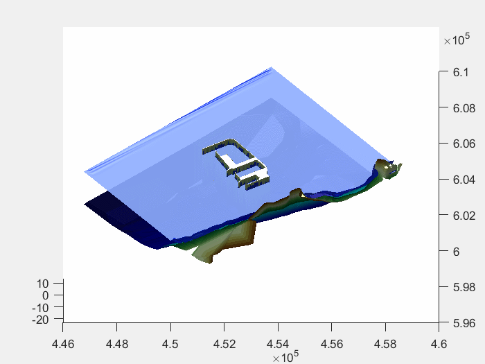
The entire maritime infrastructure is protected by a 7-kilometer breakwater, covering a total area of 1,650 hectares.
Located on a long sandy stretch between the Atlantic Ocean and a saltwater lagoon, this port is set to become an important hub for global trade. It will connect several regions, including West Africa, the Middle East, Europe, North America, the Canary Islands and even South America.
A key feature of this development is the 1,300-meter access bridge, which connects the port to the mainland via a reinforced embankment.
Our touch :
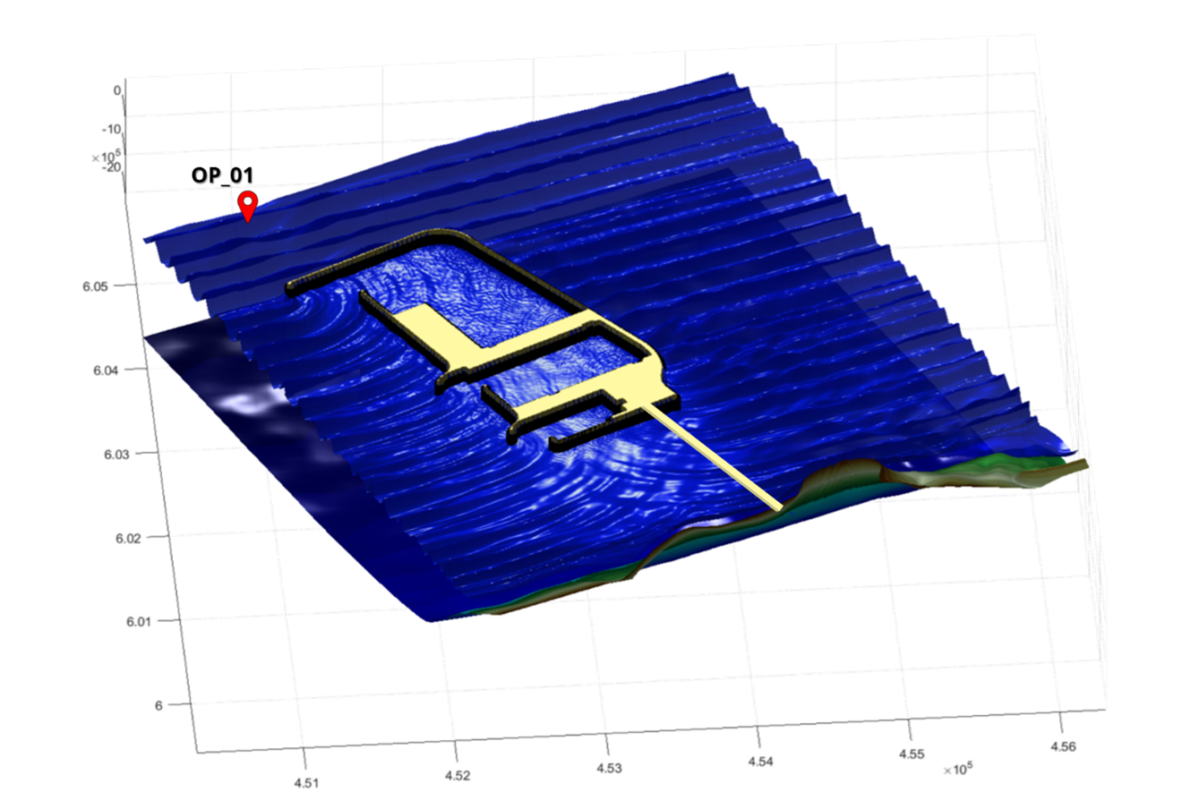
To ensure that the lower deck of the new access bridge to Dakhla Port is not affected by waves, HAEDES conducted a set of numerical simulations using the SWASH model for SGTM (Société Générale des Travaux du Maroc).
This project began with gathering data followed by a statistical analysis of extreme wave conditions. HAEDES developed an updated Digital Terrain Model (DTM) and analyzed wave propagation towards the study site using the phase-averaged SWAN model, which was calibrated with wave buoy measurements. Then, using the SWASH model – a phase-resolving wave model that simulates wave movement towards the coast and its changes, such as sharpening wave crests and flattening troughs in shallow waters – HAEDES assessed how waves behave under extreme conditions, focusing on the maximum sea surface elevation along the access bridge.