Narrative :
This project is carried out together with Aqualogus, on the behalf of the Portuguese Environment Agency (APA).
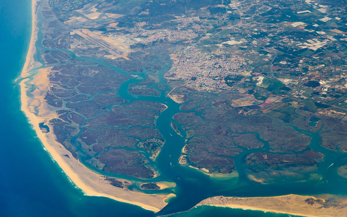
This project, ongoing until 2024, comprises two monitoring components, associated to two sites: the estuary of Mira River, in the southwestern Portuguese coast, and the beaches of Barril, Farol and Cavacos, located in Ria Formosa, in the Portuguese south coast.
The monitoring of the estuarine bottoms of Mira River estuary comprises topo-hydrographic surveys, beach profiles and granulometric analysis of beach sediments, as well as observations of the efficiency of a sediment retention system.
The monitoring program of the Geomorpholy component of the action plan for the valorisation of Ria Formosa hydrodynamics and mitigation of risks in barrier islands comprises the acquisition of topographical beach profiles to evaluate the system recovery capacity after dredging interventions in the Ria Formosa channels, where removed sediments were reused for dune recovery and beach nourishment.
Our touch :
Our assignment consists of performing the geomorphological monitoring of Mira River estuary and beaches in Ria Formosa , which includes:
- Follow the evolution Mira estuary through the monitoring of the morphology of the emerged zones, topo-hydrography and channel positioning, submerged bar and adjacent intervened beaches;
- Evaluate the sedimentation patterns to infer potential needs of maintenance dredging;
- Identify tendencies of alteration in the natural systems balance through the timely detection of critical erosion/accretion situations;
- Define actions for the minimization of potential negative impacts
- Monitor the performance of measures for beach reinforcement through the identification of potential sediment losses by the system and of the evolution of the dune system
